
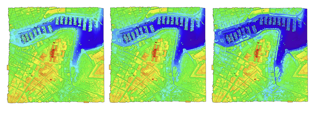
Over a decade after a bathymetric scan surveyed the islands’ coast to find out what lurks underwater, Malta’s seabed is about to be scanned again using laser technology, to give researchers and the general public an insight into the underwater through interactive 3D seascape.
A bathymetric survey is a study that maps the depths and shapes of underwater terrain, while depicting the shapes and features of a shoreline.
Project DaSLiM (‘Developing a Spatial LiDAR Bathymetric Dataset for Marine Research’) was launched by Prof. Saviour Formosa on Monday 15 July 2024, saying that this second scan will provide us with an update to the 2012 dataset and also create a 2024 coastal bathymetric map.
The LiDAR scans are designated to scan 15 metres of the seabed, but Malta’s scan, achieved reliable information at 50 metre depths.
The first bathymetric scan took place under the ERDF 156 project in 2012 when 3D aerial surveys monitored the island’s air, water, soil, radiation, noise, and 3D terrestrial and bathymetric surveys. It discovered L-Għariebel Doline Complex, an offshore land feature off the northeast coast of Malta.
“With the new data, we will be able to monitor and compare how the water levels across the Maltese coast, have changed and will help us to predict how it will change in the years to come,” Prof. Formosa said.
All the data will be made available online online, where the public can already find the bathymetric data for 2012 and the 2012-2018 terrestrial data.


